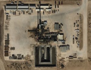
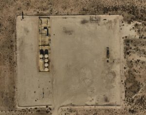
 The mention of aerial imagery usually brings visions of drones, and that is certainly a big part of the mix. Additionally, companies like Ft. Worth-based Prius Intelli are using manned, fixed-wing flights to quickly cover wider areas and collect more data than is afforded by just visual images. With regulators clamping down on greenhouse gas (GHG) emissions such as methane leaks, targeting the Permian Basin in particular, rapid data gathering and information processing are becoming more and more vital to avoiding fines and protecting assets.
For Hunter Herren, who is co-CEO along with Josh Vineyard, the key is clear data and speed. Fixed-wing manned flights cover hundreds of square miles in a day in a single flight. Photography and GIS data inform clients—in the Permian Basin, that’s usually producers and midstream companies—on how to quickly make decisions. “You pair the quality of the imagery with the scalability of the collection and processing, and then you add that it’s an affordable data product, that’s the sweet sauce,” Herren said.
Among the main uses for aerial data is site planning, said Perry New, Prius Intelli’s vice president of data integrity. “A lot if it is around getting data that they can plan with; site selection for oil and gas facilities, pad sites, compressor sites, access roads, just whatever.” He added that regulatory compliance issues have increased in recent years, beyond just oil and gas itself. Avoiding elk migration patterns, wetlands, and other wildlife habitat issues—especially an issue for cross-country pipeline planning—has become a new priority under both state and federal guidelines, and aerial imagery is perfect for spotting these issues.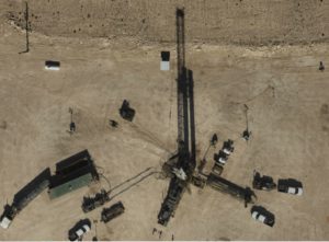
Clients are often seeking to understand the nature of the terrain—flat or hilly—along with drainage patterns, proximity of roads, buildings, homes, and the power grid, among others. That information can inform planning for earth moving, access through surface ownership issues (is a road already nearby, or can one be built across private land?), and a long list of other needs. “All of that goes into the planning stage for any kind of oil and gas asset,” New explained.
Producers, said Ethan Sparks, the company’s vice president of solutions, are often looking for updated surface photos to compare with their GIS data, the latter of which shows elevation contours. Overlaying the GIS data with the photo provides a complete image of the site’s current buildings and equipment.
Midstream clients use it for those requirements as well as for route and re-route planning, Sparks noted. A key ongoing benefit of aerial imagery to pipeline companies lies in regulatory compliance, maintaining the proper leak class verification, involving High Consequence Areas as defined by the Pipeline and Hazardous Materials Safety Administration.
To determine what sections of a pipeline need the fastest response in case of a leak, PHMSA has ranked pipeline routes by their proximity to homes, retail, and businesses, in four levels. Levels 1 and 2 designate essentially remote rural areas. Pipeline sections that run near high population and densely-packed structures get a four. Level Fours, which are HCAs by definition, require the greatest amount of area monitoring and hazard response preparedness.
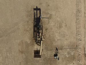 Because of the higher level of monitoring required, midstream companies often employ aerial imagery to monitor HCAs for any changes in nearby structures, to comply with PHMSA regulations, and to keep the area safe. When possible, New noted, lines may be routed around high density areas to avoid the greater compliance issues involved there.
In oil and gas, New sees larger producers as having the greatest resources to make use of this data. “What we’re seeing is that a lot of these larger companies that have the resources for really high-end GIS and data gathering capabilities, they’re really leveraging this type of technology, and they understand the costs that they’re reducing,” he said. Those larger companies may not need outside help for managing GIS data.
“But for some of the smaller companies, they really don’t have the ability to leverage it to the same degree. So that’s where we come in with a platform-agnostic delivery, to where you don’t have to have a really super high-end GIS system to be able to consume the data that we’re providing.”
Alternate sources of data such as satellite maps or ground-based surveys have drawbacks, Sparks noted. Because satellite photos can be months or years old, he referred to it as “stale data” compared to aerial shots taken upon client demand.
On-demand imagery can be customized for location, amount (number of square miles) resolution (up-close or further out), and time frame. “We collect everything on a project-specific basis, which ensures fresh data,” he said. Terrain elevation modeling and planometric data, meaning features digitized out of the imagery, are also available, along with GIS mapping.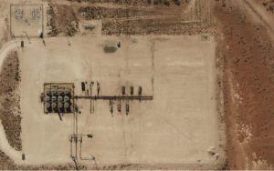
Herren, New, and Sparks agreed that the regulatory landscape covering GHGs is likely to get rougher for the industry, and vigilant monitoring will become more and more vital for avoiding fines and adverse action. Regular aerial surveillance will likely be the most cost-efficient method for pinpointing leak locations for immediate repair.
Texas Railroad Commission’s Drone Training Program
Hardly anyone thinks about licensing for drone pilots—although it does exist—but there is a training program for anyone who wants to be licensed or simply to learn to avoid slamming their drone into tank batteries or crash landing into a produced water pond. Launched in 2020, the training program, operated by the Texas Railroad Commission (RRC), came about because the agency’s Oil and Gas Division “utilizes drones to help inspectors quickly respond and inspect sites that are unsafe or inaccessible during emergencies such as fires, flooding, and other natural disasters,” said the RRC in an email interview. In addition, the Surface Mining and Reclamation Division uses drones for regular inspections.
 The program’s training video recently won a national award for excellence. According to a TRRC press release, “The Railroad Commission’s Surface Mining and Reclamation Division (SMRD) has earned national recognition for excellence for its drone training program—training that highlights safety and operational efficiency.”
The award came from the Interstate Mining Compact Commission, through the IMCC’s National Mine Safety and Health Training Award, in the state category for Coal Surface Mining. The award recognized RRC video training that highlights SMRD’s use of drone technology in the field, including pre- and post-flight procedures, drone inspection efficiency, and how drones maintain safe distance between multi-ton mining equipment and inspectors. Those last two sound really important, especially for the mine inspectors.
For the video, the intended audience “includes the agency’s inspection and enforcement staff, regulated industry representatives, and landowners.”
Actually the video is separate from the RRC’s pilot training—the whole program is a 100-hour course that includes flight experience and classes. Each pilot who passes receives an FAA Part 107 Remote Pilot’s License.
The oil regions in most states, Texas included, are spread out far and wide, making ground-based access time consuming and, depending on road conditions, dangerous. The industry’s growing need for efficiency-related profitability boosts, along with the increasing shortage of staffing options, are causing more operators to look at aerial data gathering—manned or unmanned—as optimal or even necessary options.
______________________________________________________________________________________________________
By Paul Wiseman


